Most people think of Beaufort Street as a dining strip in Highgate and Mount Lawley. But the street begins in the city, among Perth’s major cultural institutions, and its southern blocks tell their own story about how Perth grew north.
1848
On the map by
Street recorded from at least the 1840s
1937
Bowra & O’Dea building
Inter-War Functionalist
2020
Boola Bardip opened
New WA Museum
The name
A popular story says Beaufort Street was named after the Duke of Beaufort. Local history writers at Dodgy Perth argue that this is a myth, and that the street was named after Rear-Admiral Sir Francis Beaufort, the Admiralty’s chief hydrographer and the man behind the Beaufort wind scale. Many early Perth streets honoured figures from the Colonial Office and the Admiralty. The street is recorded from at least the 1840s.
Museums and galleries
The southern end of Beaufort Street borders the Perth Cultural Centre, a pedestrian precinct home to:
- WA Museum Boola Bardip, the state museum, which reopened in a new building in 2020 incorporating heritage buildings on the site;
- the State Library of Western Australia;
- the Art Gallery of Western Australia;
- the Perth Institute of Contemporary Arts (PICA) in a heritage former school building.
The Western Australian Museum’s history notes the museum’s long presence on this site. The City of Vincent records that builder Simon Bremner Alexander, who later built the Astor Theatre, also built additions to the Museum and the Police Court buildings on Beaufort Street.
Northbridge’s edge
West of Beaufort Street, Northbridge is Perth’s nightlife and multicultural dining district. East is the city’s fringe of offices, apartments and older commercial buildings. The street here is busy with buses and traffic, and it is less of a strolling street than Highgate, but it rewards a closer look.
Heritage along the way
Heading north from the Cultural Centre, look for:
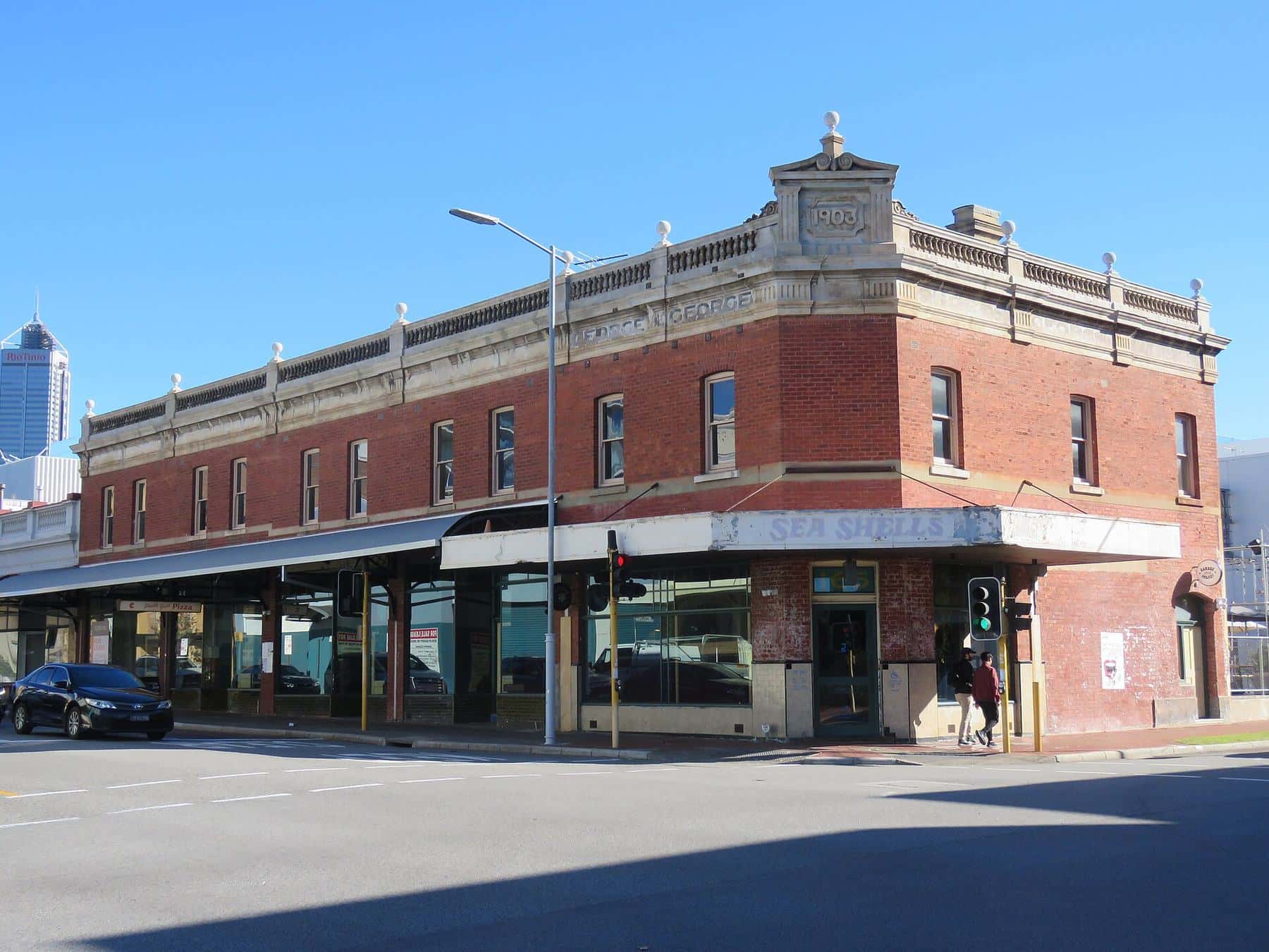
- Interwar and Federation commercial buildings, such as the block at 151–165 Beaufort Street;
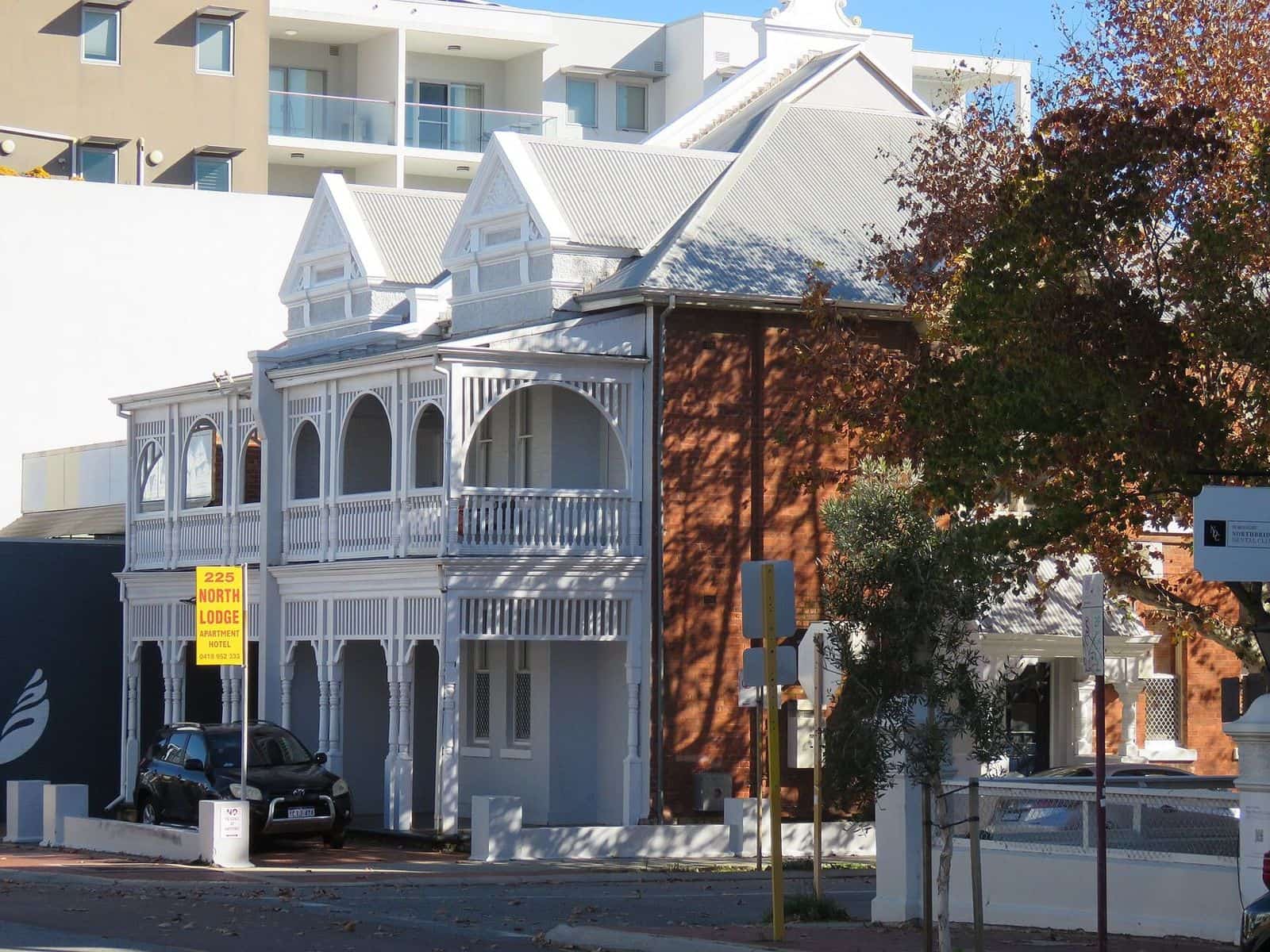
- the terrace houses around 225–241 Beaufort Street, rare survivors of 1890s housing close to the city;
- the Bowra & O’Dea building at 359 Beaufort Street, purpose-built in 1937 as funeral directors’ offices, chapel and mortuary. inHerit records that it was designed by architect Samuel Rosenthal in the Inter-War Functionalist style and is on the State Register.
See heritage buildings for more.
Wetlands under the streets
The land around the southern stretch of Beaufort Street was once part of a chain of seasonal wetlands important to the Whadjuk Noongar people. An 1858 map of the Perth townsite, held by State Records and reproduced by the City of Vincent, shows swamps across the area. Stone’s Lake, known to Noongar people as Yoordogoorading, lay near today’s Perth Oval (HBF Park). It was filled in and subdivided from the 1850s for market gardens, homes and small farms. Today it is a registered Aboriginal heritage site.
St Alban’s and the edge of town
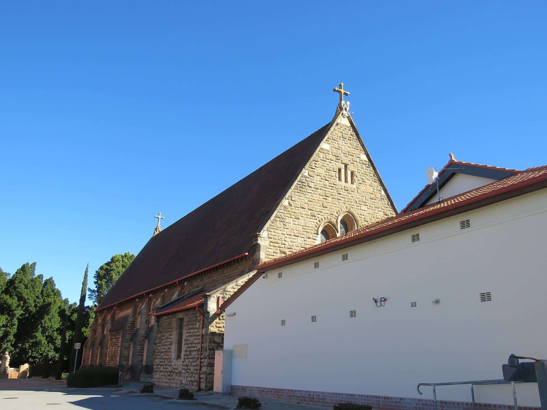
Where Beaufort Street meets Lincoln Street stands St Alban’s Anglican Church. The City of Vincent records that the Church of England was granted land here in the 1870s, and open-air services began under a large gum tree in 1889. In 1891 Beaufort Street was paved only a short way past the church, with bushland beyond. In other words, the church marks where the city ended and the suburbs began.
Turning points
The Highgate Hill Police Station at 57 Lincoln Street was established in 1897, the first police station and lockup north of Perth. A few years later, in 1900, the tram extended along Beaufort Street, and the city’s edge moved north with it.
Why visit the city end
The city end is often overlooked, but it rewards an early start. You can combine one of the state’s best museums with a heritage walk and finish with lunch in Highgate. It is also the most convenient place to start if you arrive by train, since Perth Station is close by. Allow a morning for the museum and an hour for the walk north.
Crossing into Highgate
As Beaufort Street climbs past Lincoln Street, the city gives way to Highgate’s shops, churches and pubs. Walking from the Cultural Centre to Mary Street takes around 25 minutes at an easy pace. Read our Highgate guide.
Tips for visiting
- Combine culture and food. Spend the morning at the museum or gallery, then walk or catch a bus up Beaufort Street for lunch.
- Check opening hours. Cultural institutions have their own hours and may close on some public holidays.
- Mind the traffic. Use signalised crossings, as the street carries heavy traffic.
- Go by public transport. Perth Station and the Perth Busport are nearby; see getting here.
City end checklist
0 of 6 done
Ticks are saved in this browser only.
A street that grew north
The order of buildings along Beaufort Street reads like a timeline. Civic and cultural buildings sit near the city, 1890s housing and shops follow, then Federation and Art Deco buildings in Highgate and Mount Lawley, and finally Inglewood’s 20th-century suburban strip. Walking the whole length is a lesson in how Perth expanded in the gold boom and the tram era.
Continue
Head up to Highgate, or explore our history hub.
Frequently asked questions
Who is Beaufort Street named after?
Local historians say it was named after Rear-Admiral Sir Francis Beaufort, the British Admiralty’s chief hydrographer, not the Duke of Beaufort as is sometimes claimed.
What is at the southern end of Beaufort Street?
The Perth Cultural Centre, including WA Museum Boola Bardip, the State Library of Western Australia and the Art Gallery of Western Australia, is beside the southern end of Beaufort Street on the edge of Northbridge.
Is the city end walkable?
Yes. It is a short walk from Perth Station and the Perth Busport area, and the street continues on foot to Highgate in around 20–30 minutes.
Where does Beaufort Street start?
It begins on the northern edge of the Perth CBD beside the Perth Cultural Centre and Northbridge, then runs north-east through Highgate, Mount Lawley and Inglewood.
Sources and further reading
Facts on this page were checked against these primary and official sources. Conditions change — confirm before you travel or buy.
- Highgate history — City of Vincent Library & Local History Centre
- Where the streets have no name — Dodgy Perth
- Beaufort Street — Wikipedia
- History of the Western Australian Museum – Perth — Western Australian Museum